Munich has more mapped recreational walking routes within city limits and the immediate surrounding countryside than any other German city except Berlin — 1,200 kilometres in total, according to the Bavarian State Office for the Environment's 2025 trail audit. This summer, demand for outdoor fitness options has visibly surged, with the city's parks reporting noticeably higher foot traffic since June. Whether you have 45 minutes or a full Saturday free, the options range from pancake-flat riverside strolls to genuine lung-burners in the foothills of the Alps.
The timing matters. Munich's urban population has grown by roughly 14,000 residents since 2023, adding pressure to indoor fitness infrastructure — some popular studios in Schwabing and Maxvorstadt now operate waitlists for peak-hour slots. Meanwhile, wellness research published earlier this year by the Technische Universität München found that 30 minutes of brisk walking in green spaces measurably reduces cortisol levels, a stress hormone, more effectively than equivalent time on a treadmill. The city's own Gesund.Leben.Bayern public health programme has been citing that data in its summer outreach since May.
The Easy Tier: City Loops for Beginners and Recovery Days
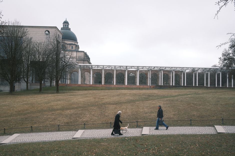
The Englischer Garten remains the obvious starting point. The full perimeter loop clocks 8.7 kilometres on flat ground, with almost no elevation change. Start at the Chinesischer Turm in the southern section and walk north along the Eisbach channel — the path is well-marked, shaded for most of its length, and passes three beer garden stops if motivation flags. It's genuinely accessible: suitable for older adults, post-injury recovery, and anyone pushing a stroller. Completion time for an average pace is around 90 minutes.
Slightly less obvious but worth the detour is the Isar-Hochuferweg, which runs along the eastern bank of the Isar between the Maximilianeum and the Flaucher leisure area. This 6-kilometre route has some gravel sections and one short, steep bank descent near Wittelsbacherbrücke — call it a difficulty rating of two out of five. The riverside meadows here were redesigned between 2018 and 2022 as part of Munich's Isar Plan, and the ecological rehabilitation means the path now winds through proper riparian woodland rather than concrete embankment.
Intermediate and Advanced: When You Want to Actually Feel It
For a genuine cardiovascular challenge still reachable by public transport, the Forstenrieder Park trail system in the city's south is the answer. The longest marked loop is 18 kilometres, takes roughly four hours at a moderate pace, and gains about 120 metres of elevation — modest by alpine standards, but enough to notice on the return leg. The forest is managed by the Bayerische Staatsforsten authority and entry is free year-round. The trailhead is a 12-minute walk from the Fürstenried West U-Bahn stop on line U3.
Step it up further and the Schäftlarn–Berg am Laim ridge walk, accessible via the S3 S-Bahn to Deisenhofen, offers 22 kilometres of varied terrain including exposed ridge sections with views back toward the Munich skyline on clear days. Elevation gain sits around 340 metres total. This one earns a four out of five on any honest difficulty scale. Footwear matters: trail shoes are strongly recommended, and the descent sections after Grünwalder Forst are steep enough to be slippery after rain.
The Munich Hiking Association — the Deutscher Alpenverein's Munich section at its Praterinsel headquarters — publishes updated trail condition reports every Friday through its online portal, including seasonal alerts for muddy or storm-damaged sections. Annual DAV membership starts at €67 and includes access to their full digital trail library and guided group walk programme, which runs fortnightly throughout July and August.
Before heading out on any route beyond the city parks, check the weather forecast through the Bavarian State Meteorological Office — summer afternoon thunderstorms in the foothills can develop quickly after 2 p.m. Carry at least 500ml of water per hour of planned walking, and if any of these routes are your first sustained outdoor exercise after a long break, a brief check-in with your Hausarzt is worthwhile before tackling the longer distances.